Mappedin for First Responders
Maps for Good
FREE indoor mapping for public safety.
Firefighters, police, and EMS teams are invited to create, update, and share high-quality indoor maps with free access to our self-serve indoor mapping platform on the Advanced tier.

Get Mappedin before you go in
Stop relying on PDFs and printed maps and create a single digital source of truth for the indoor spaces in your communities.
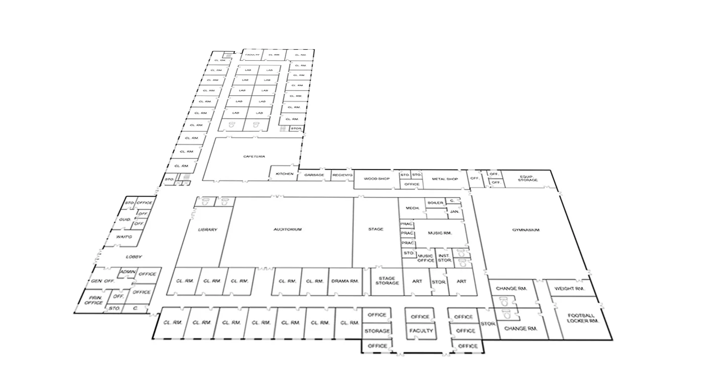
Instant PDF conversion
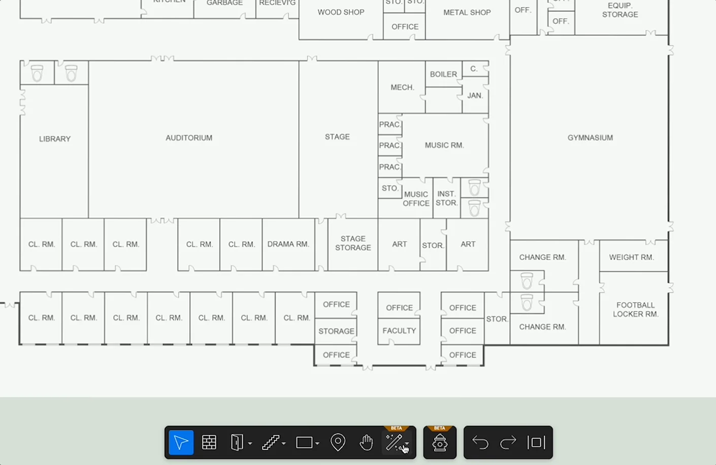
Convert thousands of PDFs in minutes. Use our AI floorplan-to-map transformation to convert image files individually or at massive scale with automated digitization of structural features, labels, objects, room details, and POIs.
Unrestricted use and scale
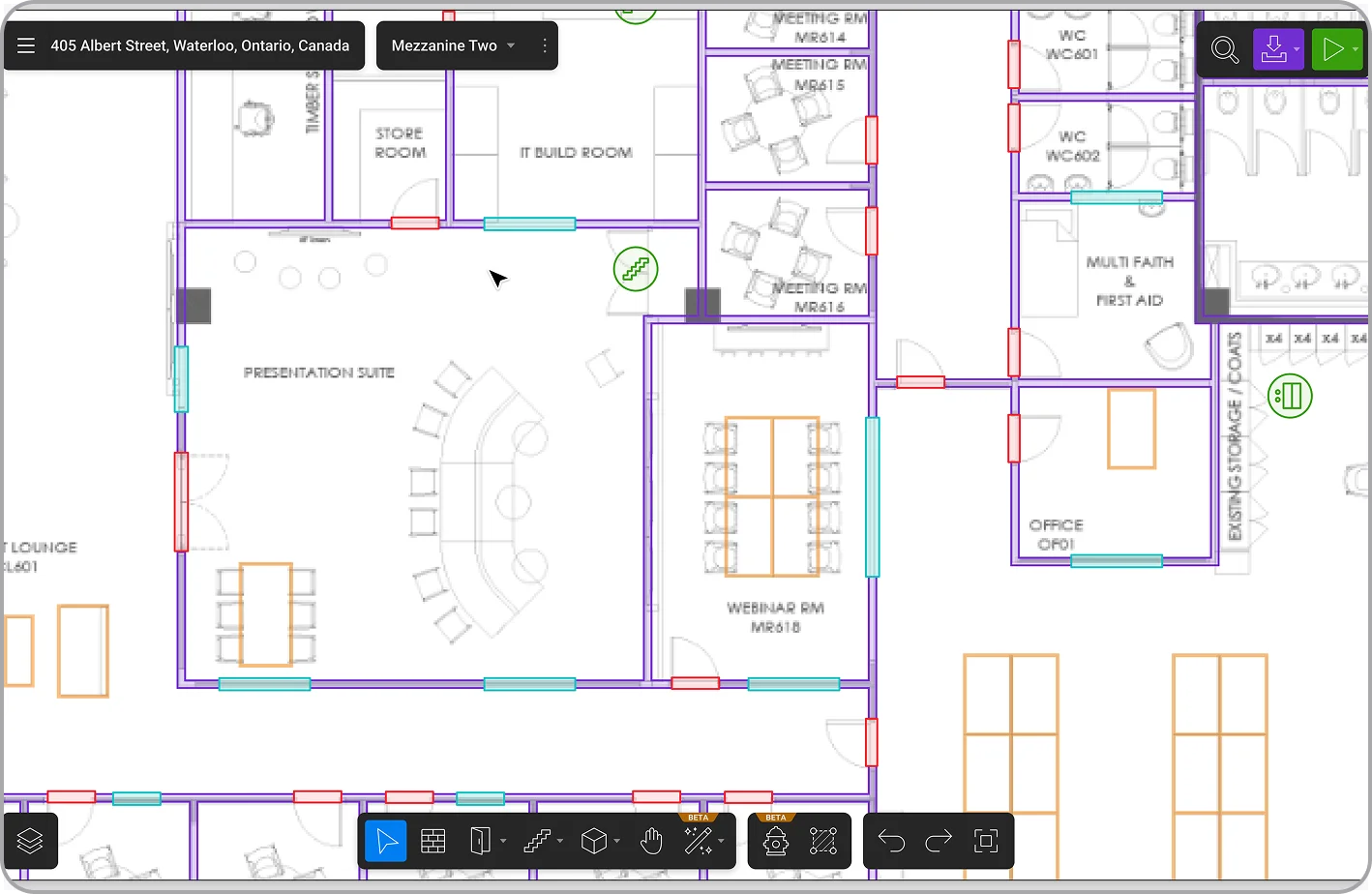
Our step-by-step, intuitive mapping platform provides full- feature access to teams of any size for projects of any scope, with no prior experience required.
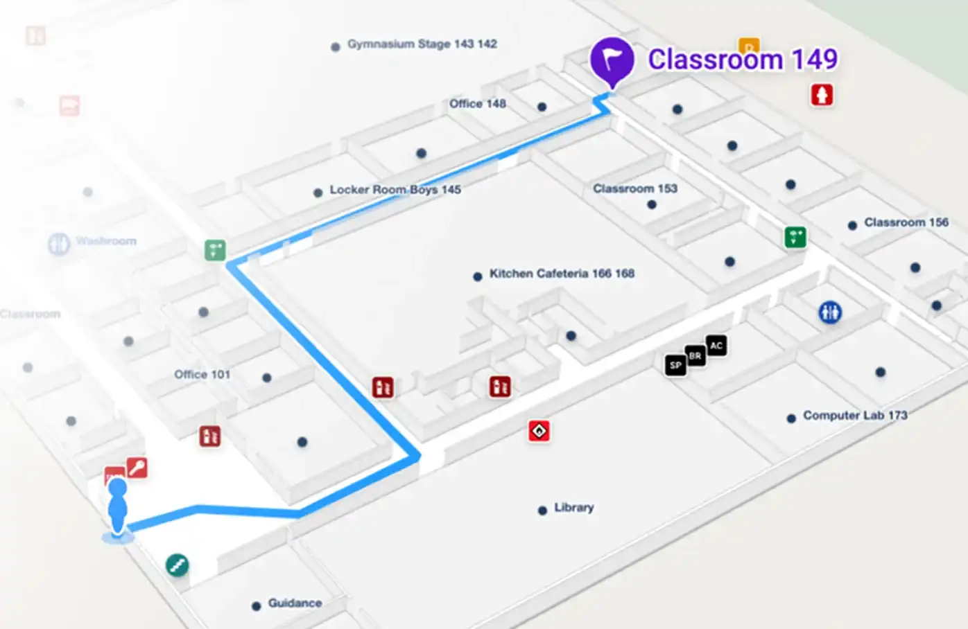
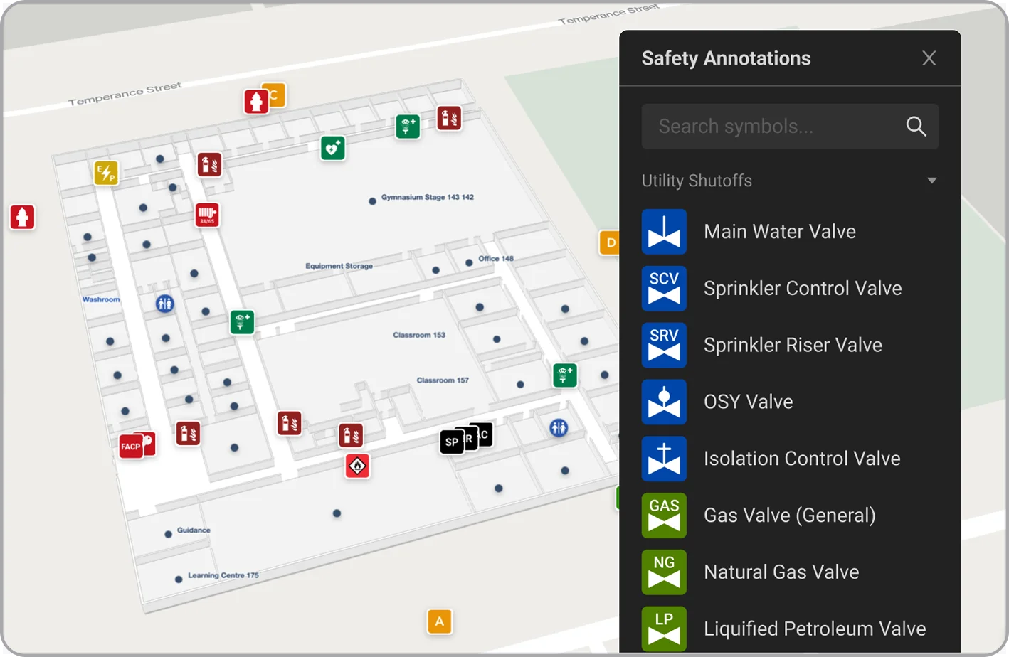
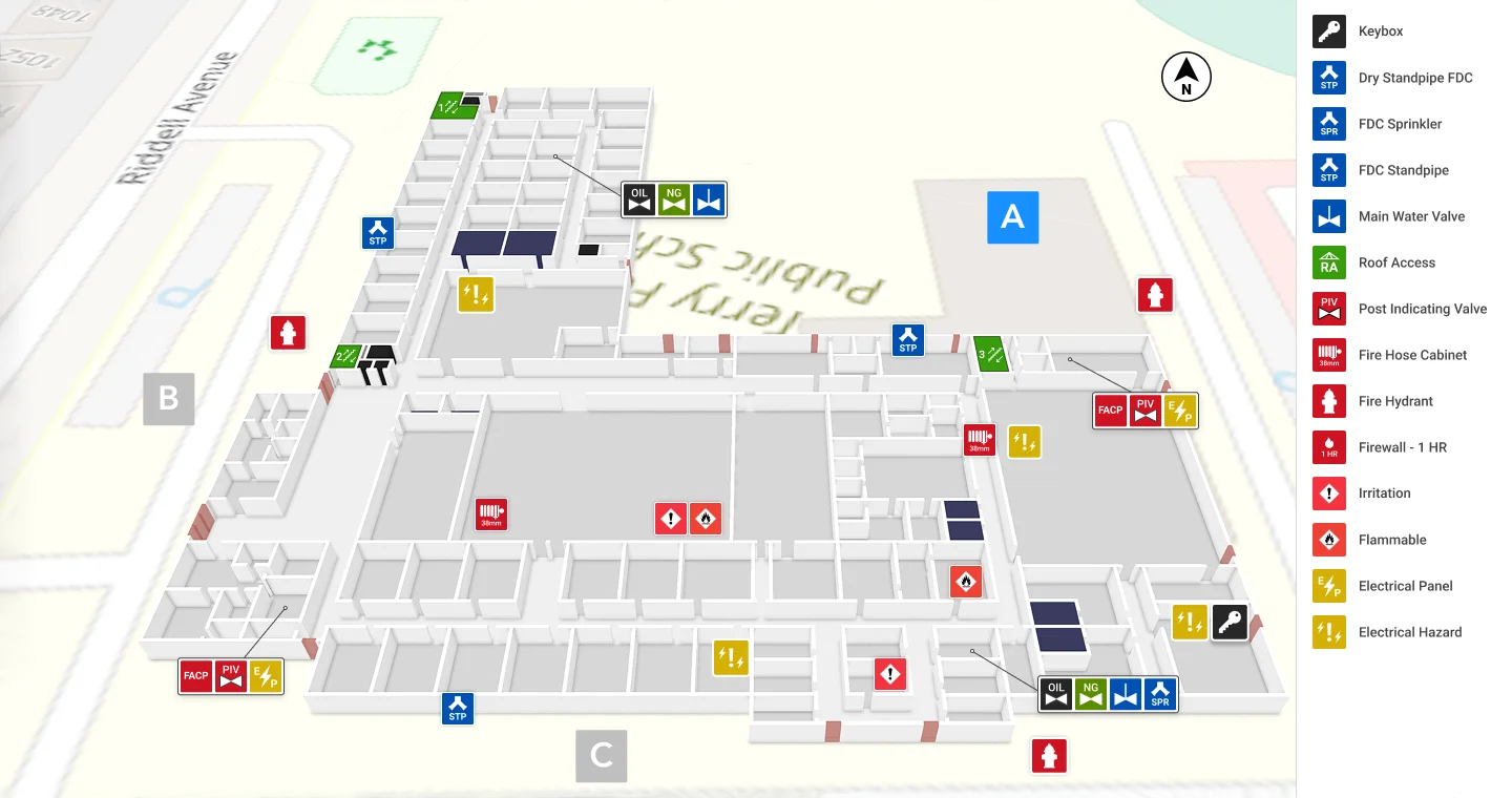
Standardized safety design
Pinpoint safety-specific POIs and equipment within locations. Use powerful map customization and a standard safety icon palette for accurate locating and easy emergency access.
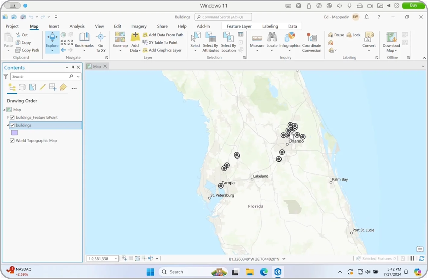
GIS integration
Your GIS teams will love it too! Once your safety maps are created with Mappedin, they can be easily integrated into ArcGIS Pro.
ArcGIS pulls your maps into the location metadata as quick links to the Mappedin map viewer and editor of each individual indoor map.
By clicking on building polygons and quick map links created with Mappedin, you can instantly zoom, pan, search and navigate indoor 3D maps. With all your indoor maps easily accessible and editable in one place, you can ensure your data stays up to date.
Instant PDF conversion
Convert thousands of PDFs in minutes. Use our AI floorplan-to-map transformation to convert image files individually or at massive scale with automated digitization of structural features, labels, objects, room details, and POIs.
Unrestricted use and scale
Our step-by-step, intuitive mapping platform provides full- feature access to teams of any size for projects of any scope, with no prior experience required.
Standardized safety design
Pinpoint safety-specific POIs and equipment within locations. Use powerful map customization and a standard safety icon palette for accurate locating and easy emergency access.
GIS integration
Your GIS teams will love it too! Once your safety maps are created with Mappedin, they can be easily integrated into ArcGIS Pro.
ArcGIS pulls your maps into the location metadata as quick links to the Mappedin map viewer and editor of each individual indoor map.
By clicking on building polygons and quick map links created with Mappedin, you can instantly zoom, pan, search and navigate indoor 3D maps. With all your indoor maps easily accessible and editable in one place, you can ensure your data stays up to date.
Join Maps for Good
Apply today!
To join our Maps for Good initiative, complete and submit the form to speak with us about your organization and your safety projects.
Learn more about the exciting opportunities to join us in our mission to map the indoors for public safety, emergency planning, and incident response.

This is the most important tool for saving first responders’ and victims’ lives in the past 50 years.