Mappedin for airports
Guide your passengers, drive your business
Powerful, intuitive maps—built to elevate the passenger experience and boost your revenue.
Trusted by the world’s most traveled airports


Deliver a first-class experience
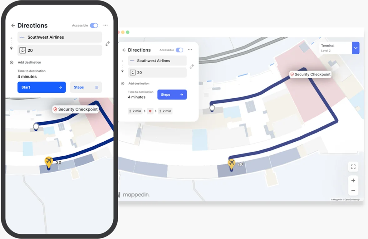
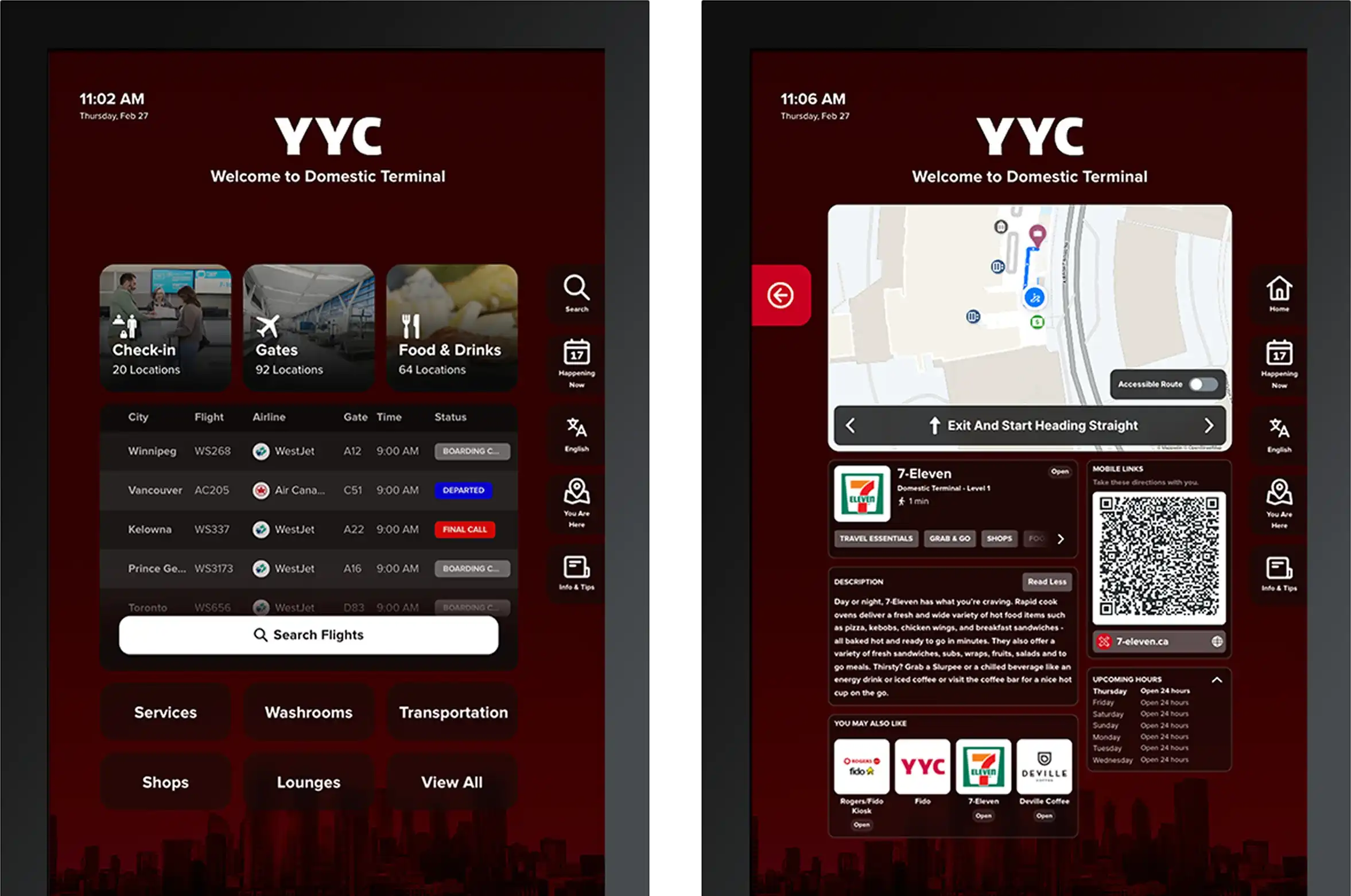
Airports are complex - navigating through them shouldn’t be. With Mappedin, you can easily guide passengers with real-time information and intuitive step-by-step navigation.
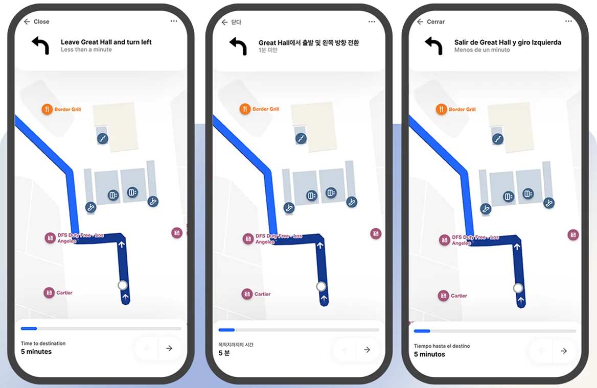
Welcome in any language
Guide passengers in their language. Reach a global audience with 40+ languages.
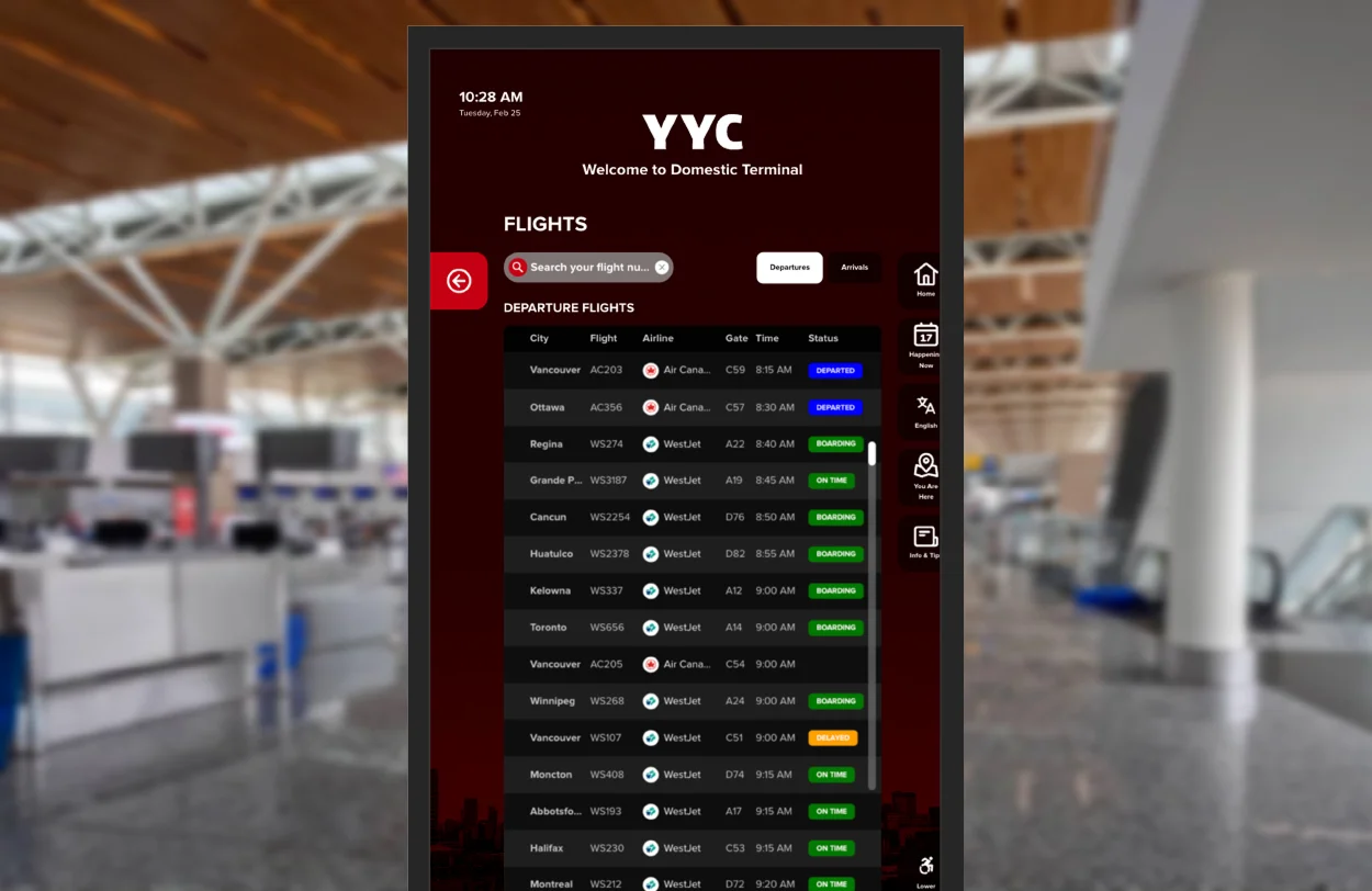
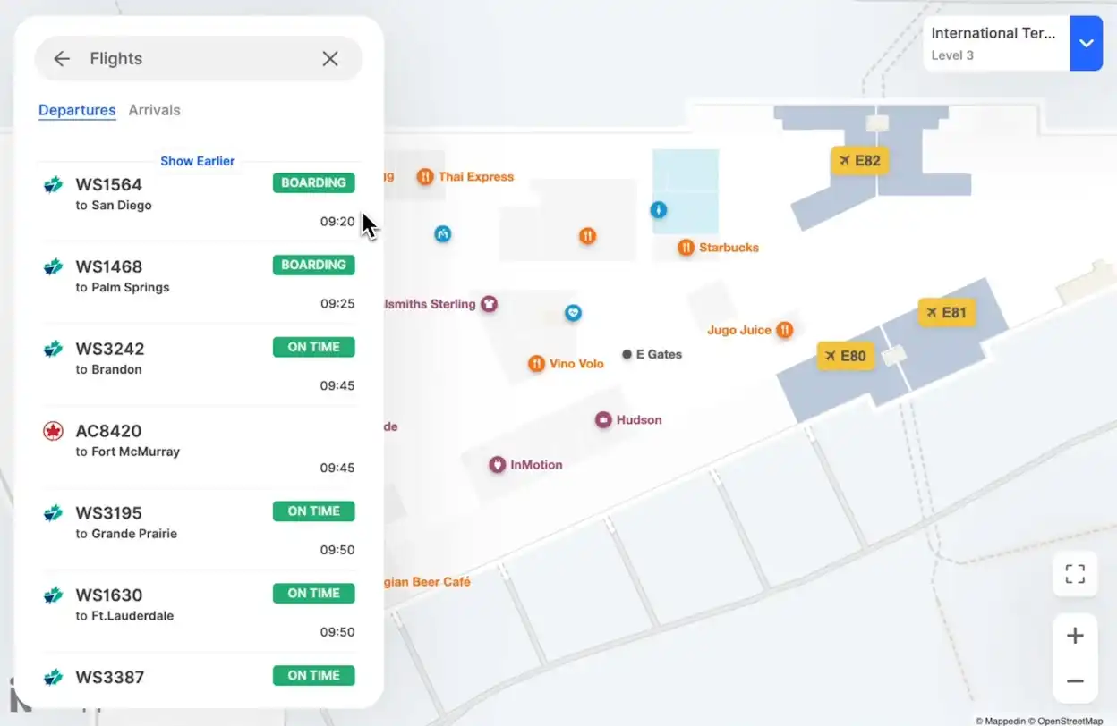
Keep passengers informed in real-time
Move passengers smoothly with real-time updates on delays, security wait times, and more.
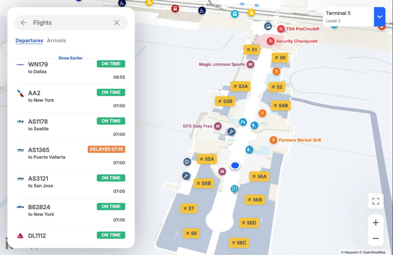
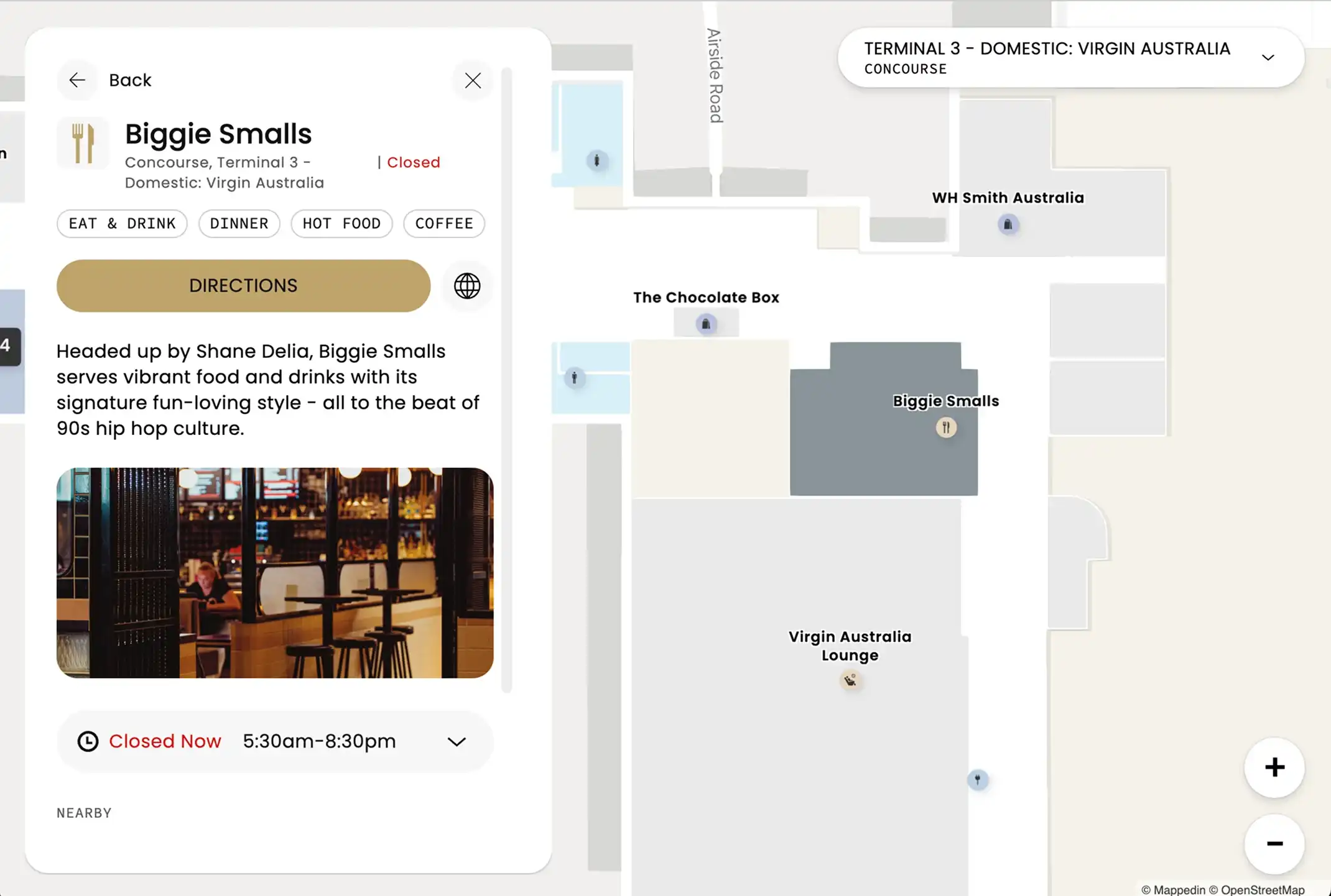
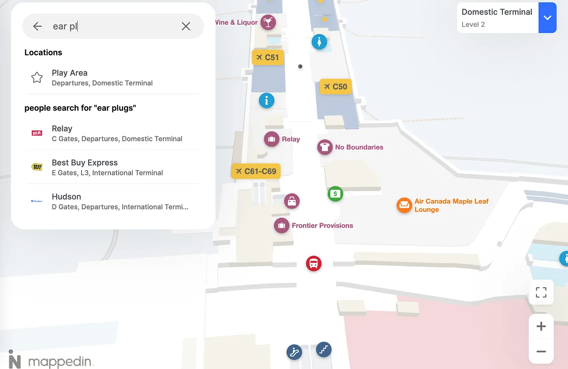
Make exploring effortless
Help passengers find what they need in seconds with smart search and top locations. Less stress, more spending—calm travelers spend 7x more.
Simplify with intelligent positioning
Get the perfect indoor positioning system for your space—powered by the latest live location technology, tailored to your airport.
Deliver a first-class experience
Airports are complex - navigating through them shouldn’t be. With Mappedin, you can easily guide passengers with real-time information and intuitive step-by-step navigation.
Welcome in any language
Guide passengers in their language. Reach a global audience with 40+ languages.
Keep passengers informed in real-time
Move passengers smoothly with real-time updates on delays, security wait times, and more.
Make exploring effortless
Help passengers find what they need in seconds with smart search and top locations. Less stress, more spending—calm travelers spend 7x more.
Simplify with intelligent positioning
Get the perfect indoor positioning system for your space—powered by the latest live location technology, tailored to your airport.
Drive traffic to boost revenue
Get the most out of every square inch by maximizing high-profit areas.
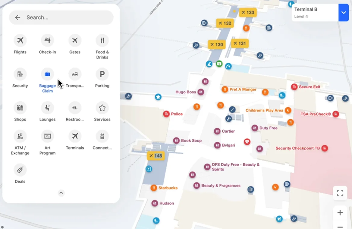
Instantly find anything
Help travelers find concessions effortlessly with clear directions to nearby shops and stores.
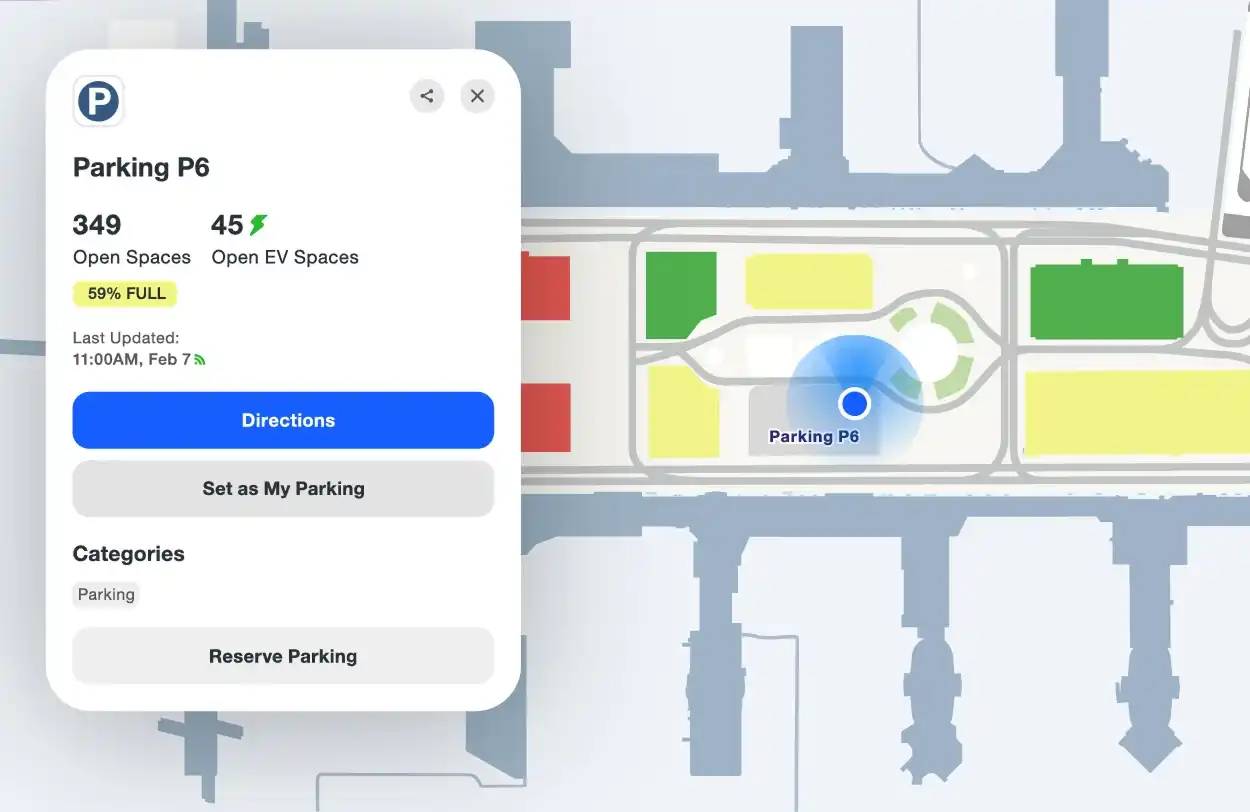
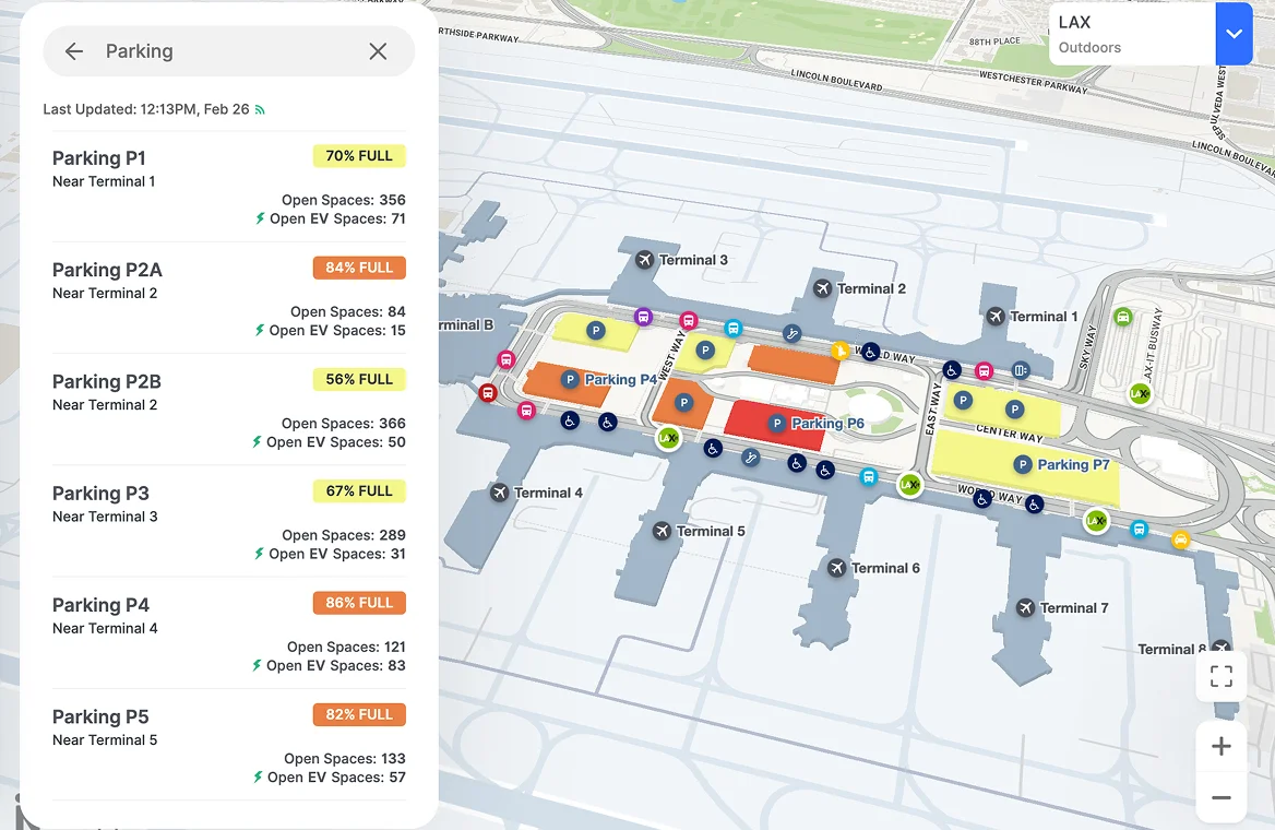
Maximize your parking
Seamless parking for travelers, more revenue for you—real-time spots, easy reservations, and smart reminders.
Turn directories into revenue
Create new revenue opportunities by promoting partners, tenants, vendors, amenities, and services on full-screen ads.
Promote events and deals
Keep passengers informed on promotions, new changes and events, all easily customizable from our content management system.
Drive traffic to boost revenue
Get the most out of every square inch by maximizing high-profit areas.
Instantly find anything
Help travelers find concessions effortlessly with clear directions to nearby shops and stores.
Maximize your parking
Seamless parking for travelers, more revenue for you—real-time spots, easy reservations, and smart reminders.
Turn directories into revenue
Create new revenue opportunities by promoting partners, tenants, vendors, amenities, and services on full-screen ads.
Promote events and deals
Keep passengers informed on promotions, new changes and events, all easily customizable from our content management system.
Connect with your passengers wherever they are

Mobile-first designs
Designed with mobile in mind, our mapping experience delivers advanced navigation on any device.

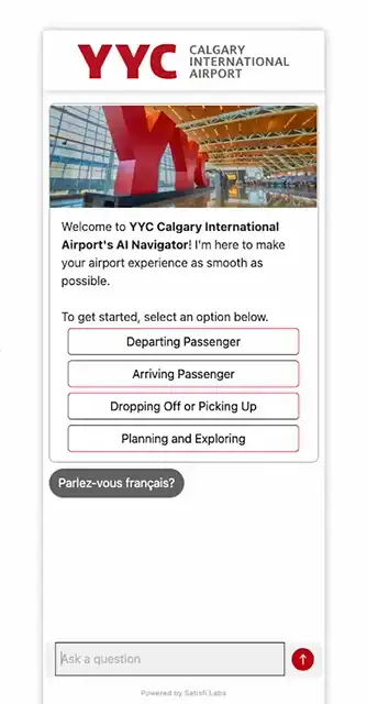
AI-powered chatbot
Instant answers on gates, dining, and flights—so travelers keep moving and staff stay focused.


Premium airport directory
Turn layovers into discoveries with Mappedin’s premium airport directory.
- Inform with real-time flight status, security wait times and transit information
- Customize display based on pre and post security locations
- Drive revenue with dynamic ads and personalized promotions

Solutions for every airport
Discover everything you can do with Mappedin for Airports.
Analytics
Passenger flow
Understand your customer journey by measuring indoor engagement and interactions.
Search data
Learn what visitors are searching for and identify new opportunities to better serve your guests.
Ad performance
Get a better understanding of how your ads and directory perform to improve your opportunities.
Analytics API
Integrate map and directory data directly to your preferred application using our API.
Integrations
Geo Data Sync
Synchronize and validate geometry automatically on a daily basis. A game-changing solution built for the complexities of airports.
Content Sync
Integrate with any CMS and automatically keep your maps and service information up-to-date with real-time location data.
Google/Apple maps
We handle your map data—seamlessly delivered to the most popular map providers.
Real-time data display
Integrate transportation data allowing for a deeper integration and a more comprehensive experience for passengers.
Airline integration
Easily share your airport map information with your preferred airline partners.
Developers
Web & Mobile SDKs
Our SDKs enables businesses to build custom indoor mapping apps with ease and integrate with any 3rd party software.
Data visualization
From heat maps to scatter plot, visualize any map or directory data to make more informed decisions.
Documentation
Everything you need to build—docs, tools, and more—all in one dev portal.
Security
Safety markers
Display essential emergency icons—like AEDs, fire extinguishers, and first aid stations—right on your map.
Crowd management
Terminal employees can adjust the flow of people in real-time with our Airport Manager app.
Dynamic routing
Draw exclusion zones around an incident or construction zone and automatically reroute passengers to safety.
Live alerts
Get real-time alerts for security updates, gate changes, and emergencies.
Professional services
Professional designs
Get beautiful, accurate maps—without lifting a finger. Our team of expert map designers works with you to create custom maps that stand out.
Dedicated support
Need to update your maps or clarify something? Our team is ready to help—quick answers, seamless changes, no hassle.
Custom development
Get a mapping solution that adapts to your needs. We build custom apps and tools that let you visualize, edit, and interact with your data—your way.
Contact our sales team
Yuval Kossovsky brings three decades of expertise in program and product management. He spent the last decade in the nascent indoor mapping space, developing the enterprise indoor mapping program for Apple and driving the global adoption of IMDF as an exchange standard for venue maps.

Yuval Kossovsky
Managing Director, Transportation
Loading...